
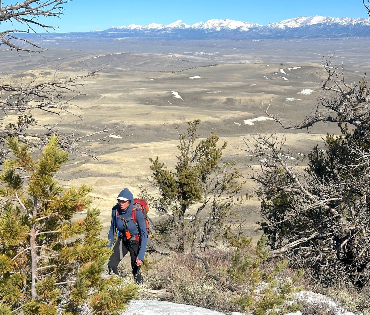
Amid a winter of record-smashing warmth and nonexistent low-elevation snow, there was one cause for optimism: Wyoming’s high mountains had decent snowpack, especially in the state’s western reaches.
Those days are gone.
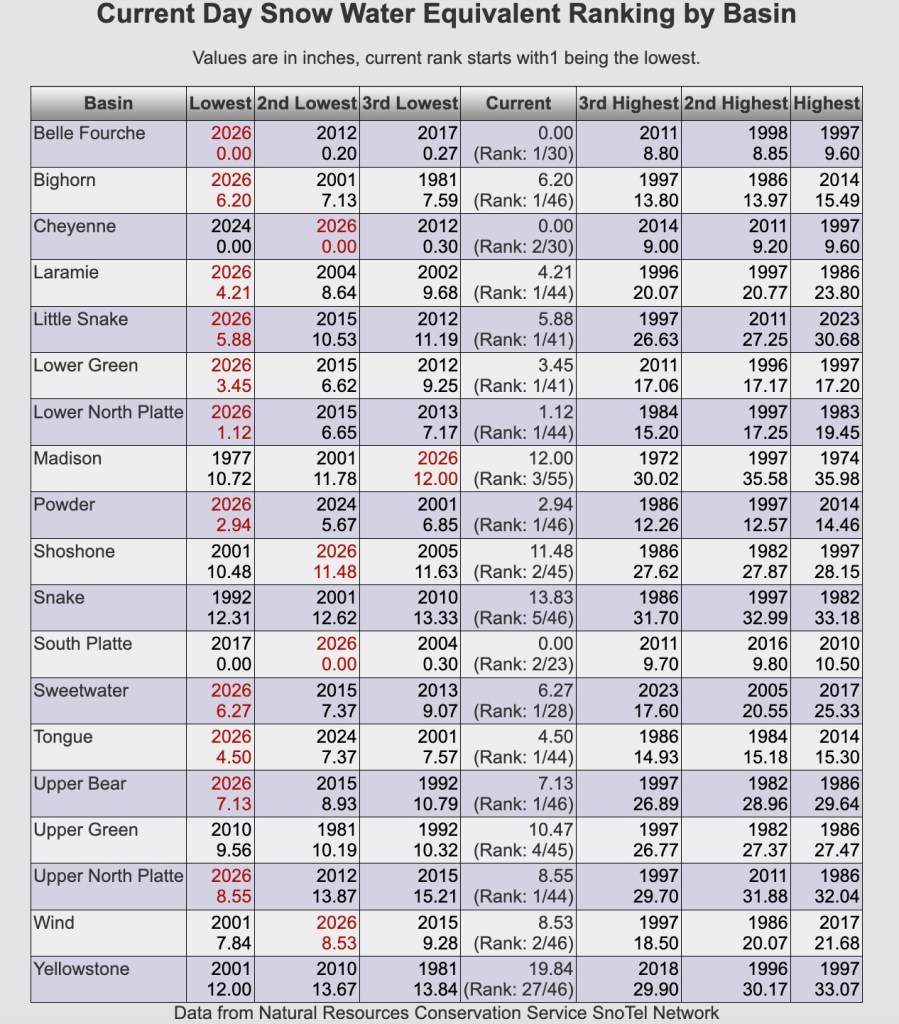
Wyoming’s mountain snowpack peaks on average the first week of April. As the monthly calendar turns on Wednesday, however, the spring melt has been underway for weeks — it’s even over in some places. The snow that is left is less than what’s ever been recorded before in 11 of Wyoming’s 19 primary river basins, according to an analysis from State Climatologist Tony Bergantino.
“Only three basins didn’t fall into the bottom three [worst snowpacks on record],” Bergantino told WyoFile.
One of those is the Snake River Basin, which as of Tuesday was experiencing its fourth-worst March 31 snowpack on record. Teton Range ski areas are scrambling as a result.
The Upper Green also isn’t in record-setting bad territory, at least not yet.
The third, the Yellowstone River Basin, is the true golden child of the 2026-27 winter. The water weight of the snowpack in that remote region is currently 97% of the long-term median — slotting it as the 27th worst snowpack in the record books.
“I’m not sure what happened up there,” Bergantino said, “but give me some more.”
Almost everywhere else, conditions are dire.
The full list of watersheds that on Tuesday were registering record-low snowpacks includes: the Belle Fourche, Bighorn, Laramie, Little Snake, Lower Green, Lower North Platte, Powder, Sweetwater, Tongue, Upper Bear and Upper North Platte river basins.
Mountain snowpack is integral to normal life in Wyoming. The melt fills streams, rivers, agricultural diversions and reservoirs. It replenishes moisture content of the soil and is a key ingredient in growing and greening up vegetation that wildlife and livestock depend on. Water managers are bracing for hard times. Lyman and Mountain View, part of the especially pinched Colorado River Basin, are anticipating municipal water restrictions.
A confluence of climatic conditions contributed to the dramatic deterioration of the snowpack in March.
“We got hit by three different things,” said Jeff Coyle, hydrologist for the Natural Resources Conservation Service’s Wyoming office. “We went in with a very low snow pack, then we had record-high temperatures.”
The third factor was a dearth of March precipitation: “It was horrible,” Coyle said. “Absolutely horrible.”

As a result, in much of Wyoming, the snowpack reached its peak one to two months earlier than average. That was the case in the southern Wyoming Range, the Snowy Range, Sierra Madre Range, Laramie Range, and also in the Bighorn Mountains and Black Hills, Coyle said.
The fast disappearance of the sparse snowpack in the Black Hills and Bear Lodge Mountains exemplified the dynamic. They feed the Belle Fourche River. On average, the snowpack there would have topped out on March 28, with the melt persisting until the first week of May.
This year, the Belle Fourche’s peak came on March 16. The amount was bad but not terrible, at 64% of the median. But what was frozen in those northeast Wyoming mountains disappeared abruptly.
“It was doing better than record low, but then we got hit by that heat anomaly that just sat on us for like a week,” Coyle said.
A week after the Belle Fourche’s snowpack peaked, it dwindled to just 5% of the long-term average. By the time the Natural Resources Conservation Service’s Wyoming office released its latest weekly snow report on Monday, the Belle Fourche snowpack was gone. The snowpack’s also gone entirely in the South Platte and Cheyenne River watersheds.

Clear across the state in the mighty Wind River Range, conditions have also taken an abrupt turn for the worse. The snowpack there on March 16 was within the normal range: 104% of the median in the Wind River Basin and 95% in the Green River Basin.
Just two weeks later, it’s a dramatically different picture. The melt in the Wind River Range has worked its way up to about 9,000 feet in elevation, Coyle said, and the Upper Green is now sitting at 66%. The east side of the range is faring slightly worse, at 64%, and the Wind River Basin is now experiencing the second slimmest end-of-March snowpack in recorded history.
Fortunately, some snow is in the forecast. Bergantino is “fairly optimistic” that an inch or two of moisture is poised to boost snowpack in Wyoming’s high mountains.
“I’m hoping like heck that this next week reverses that curve a little bit,” Bergantino said.
It’s unlikely, however, that the last gusts of winter amount to more than a blip and change the broader trajectory. Wyoming snowpacks peaked extraordinarily early, and what’s left is quickly melting off due to high temperatures.
“We’re still double digits above normal the last week, two weeks,” Bergantino said. “That just eats up a lot of snow.”
Temperatures are warm enough that rain could be in the mix this next week. “That just chews up the snowpack even more,” Bergantino said.
Nice work, Mike. And that pic isn’t just worth a thousand words. It’s worth a million, minimum.
Thanks Mike. Great report. All we can do is hope for moisture, but the fire season is likely to be bad.
Drill baby, drill.
Clear report, Mike. Thank you.
I remember the H2O conservation phrases of the past: “Save water! Shower with a friend!” and “If it’s yellow, it’s mellow. If it’s brown, it’s down!”
It’s time to revive those phrases and practice as much H2O conservation as possible!