
As an assistant professor of environmental health at Central Wyoming College, Jackie Klancher is always checking online job boards for potential positions for her students.
A little more than a year ago, she was looking at USA Jobs, a government website with postings from agencies such as the National Park Service and Bureau of Land Management, when she noticed a pattern among descriptions for tech jobs.
“Every damn last one of them brought up familiarity with GIS,” she said.

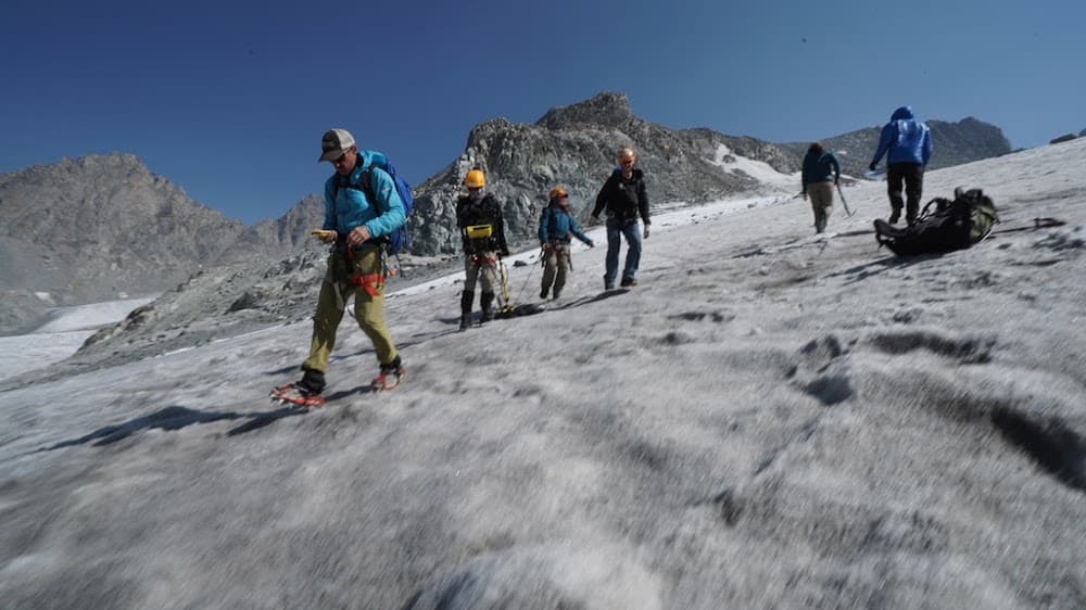
GIS, or geographical information systems, is a way to collect, store and present geographical data — primarily in digital formats. Klancher recognized the potential that GIS knowledge offers students and professionals in natural history and natural sciences: the ability to map soils and vegetation types, documenting artifacts and their locations, to mapping a perimeter of a glacier.
Last year Klancher and Central Wyoming College rolled out a full GIS program. Shortly after, the Riverton school received a Wyoming Workforce grant to provide scholarships for the program. The school, which perhaps has the most comprehensive GIS training in the state, offers an associate’s degree as well as certificate and credential programs, and is recruiting students. CWC is offering full scholarships for Wyoming residents, and discounted tuition for those out-of-state who then commit to working in Wyoming when they finish their training.
“There are jobs in this, and there aren’t trained people,” she said.
Laura Beard is a non-game biologist with Wyoming Game and Fish who leads a project inventorying and studying the bat population in the state. She enrolled in CWC’s GIS classes on her own time.
When working for an agency, there’s usually a GIS tech to help with mapping and analyzing data, she said. But that person gets swamped so it can take a long time to get projects finished.
Beard says she learns something new in every class that she can immediately put to use in her job. While she hasn’t yet finished the 30-hour program, it’s already made her a more effective biologist.

“I’ll learn something and then I’ll come in and use it,” she said.
As head of a project inventorying bats, she used to hand over the data to an analyst and try to describe what she needed an end product to look like. The skills she’s learning allow her to present her data instantly in a visual format, and it helps her to better understand her the information she’s collected.
Beard recently finished an 8-year inventory of bats in Wyoming. She hopes by the end of next semester she’ll be able to analyze her data, including where the bats were found, how they were found, how they were documented, and to look at the most recent distribution maps. She’ll be able to manipulate the layers of maps to look at different data.
Beard’s father is a landscape architect, and growing up he always told her she’d one day need GIS skills. She always told him she probably wouldn’t because she expected to work in a lab. Today anyone who works in wildlife biology or management and goes back to school for additional training studies GIS, she said.
Her neighbor is a seasonal employee with the U.S. Forest Service and she’s told him he should study GIS to make him more attractive for a coveted full-time job with the agency, she said.

“People who work on the landscape, you have to produce these products,” she said. “It makes the data look like the experience was in the field. If you are a visual person, there’s nothing like it for making sense of your data.”
Many of the students are like Beard, Klancher said. Of the 25 students studying GIS at the college, most are earning a credential or certificate, which require fewer hours of study than an associate’s degree. At a small community college, 25 students in a brand new program is significant, she said. Students come from the National Outdoor Leadership School, National Park Service and Wyoming Game and Fish Department, and private businesses.
Klancher expects the student numbers will only grow as the state faces economic decline in the energy industry and the field keeps evolving to become more accurate and easier to use. Plus, GIS training has broad applications to anyone needing to link and present data, she said. Knowing GIS skills will eventually be expected, just like using PowerPoint or Excel.
Great article. Good work CWC!
Barbara Gose