
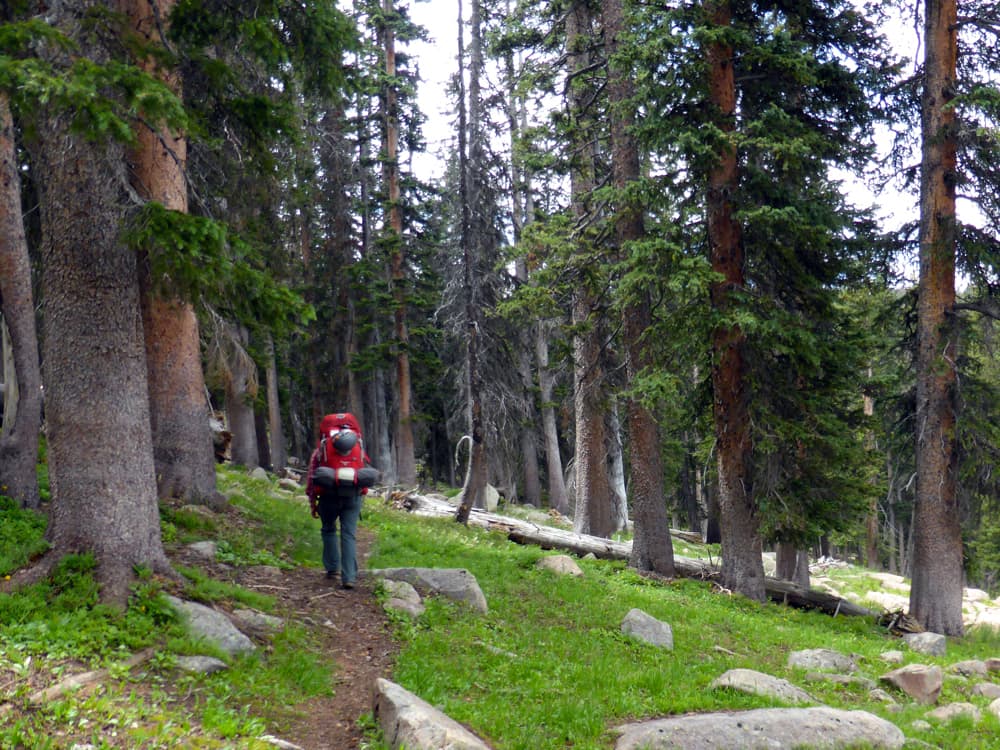
Laurel’s finger slid over the topo map, tracing the route we had followed from the Green Mountain Trailhead to here, somewhere along the Continental Divide.
In places we’d lost the path as it crossed gravelly swales or grassy meadows, but wooden posts branded with the letters CDT and held upright by piles of rocks marked the way. A cube of white quartz balanced on the flat top of each post. The trail followed the Great Divide precisely. On either side, green slopes dropped away into watersheds flowing across two halves of the country to separate oceans. To the southwest we glimpsed distant mountain ranges. We felt perched in the sky.
Matching our location to a point on the map took some effort. The quad sheet, first published in 1961 and photorevised in 1997, showed a “stock driveway” intersecting with the route from the Green Mountain Trailhead trail about the same place we’d intersected the CDT. But our map was too old to include the CDT itself. After trying to match up the time we’d been hiking with the likely distance traversed along the Continental Divide and looking around us for knobs and gullies matching those on the map, we figured out where we were.
The night before, back in Laramie, Laurel had penciled the words “Pink Towers” next to two clumps of concentric rings on the map. This was a little backpacking trip — just one night — into a little wilderness area: the 50-square-mile Huston Park Wilderness in Wyoming’s Sierra Madre. The fabled Pink Towers, which we’d read about online, lured us here. We wanted to take a summer sip of the coveted wilderness experience.

***
The Huston Park Wilderness wasn’t always on the map. In 1971 a young man named Bart Koehler came to the University of Wyoming to pursue a Master of Science degree in outdoor recreation resource management. He put together a thesis project that would let him get to know these mountains and took to exploring the Sierra Madre, Medicine Bow and Laramie ranges. Over the next couple of years, he wandered much of southeast Wyoming’s mountain country on foot, sometimes alone and sometimes with friends. The project was to identify lands with wilderness characteristics.
“My thesis work had me hiking my butt off,” Koehler wrote in an email to WyoFile, “covering as much ground as I could during a weekend and hiking to the high point(s) of each area to get the best feel for each special place that I possibly could.”
This was less than a decade after the passage of the 1964 Wilderness Act, which famously defined a wilderness as “an area where the earth and its community of life are untrammeled by man, where man himself is a visitor who does not remain.” Koehler was, like Laurel and I, drawn to the wilds, seeking the humility and awe that can only come from a long day on rough ground far from civilization and a quiet night nose-to-nose with the vast universe.

Once we were oriented, Laurel and I left the trail and scrambled onto a granite formation on the shoulder of the ridge. From this vantage, we spotted the Pink Towers below, half way down the side of a valley. They jutted like long molars from the hillside, lumps of frozen granite. The trail forgotten, we shuffled toward them, traversing a steep slope littered with ball bearing-like spruce cones and rocks.
Koehler recollected visiting this area back in the 70s. “I remember a group hike into Huston Park by a number of us from U. Wyo.,” he wrote. “We were in search of the small ponds in the northern end of Huston Park, not far from Battle Pass and the CDT. They were sphagnum ponds with floating islands of sphagnum. The place was green, and quiet, and gently rolling … and full of peace and wonder.”
Koehler’s 1973 thesis outlined the boundaries for a proposed Huston Park Wilderness designation. Once he finished his graduate degree, The Wilderness Society hired him to coordinate advocacy efforts in Wyoming. Under that organization, he mobilized citizen wilderness support from Moran to Cheyenne. Then in 1979 he dramatically quit The Wilderness Society, which he felt wasn’t doing enough to support local, grassroots wilderness preservation efforts, and helped found a new organization, the Wyoming Wilderness Association.

Meanwhile, states across the West were working on wilderness bills, Wyoming among them. Wyoming’s congressional representatives, Senator Alan K. Simpson, Senator Malcolm Wallop, and Representative Richard Cheney, were sponsoring a Wyoming Wilderness Act to resolve controversy around minerals exploration in designated wilderness areas and to determine how to manage roadless areas in limbo between conservation and development. The bill would add new wilderness acreage to Wyoming and designate the rest of National Forest lands for multiple use, which could include some minerals exploration.

The bill proposed to add four new wilderness areas to Wyoming totaling just under 480,000 acres and to prohibit mineral exploration and development in designated wilderness areas. Koehler, who’d been traveling through, advocating for, and organizing around Wyoming lands with wilderness potential for years, kicked his efforts into high gear. He and a spirited group of local wilderness proponents rallied to show the congressional delegation that Wyomingites favored more wilderness designations.
Huston Park and the surrounding country straddling the Continental Divide in the Sierra Madre was not included in early versions of the Wyoming Wilderness Act. This was one area Koehler and his colleagues pushed to have added to the bill.
In the end, Koehler and his fellow wilderness advocates managed to up the new wilderness designations in the Wyoming Wilderness Act to over 880,000 acres, nearly doubling that originally proposed. In addition, the act also added over 180,00 acres of wilderness study areas to lands in Wyoming. When the bill was signed in October 1984, Huston Park was included in those protections.
***
Laurel and I stepped over a glass-clear stream just before the Pink Towers. We weighed down cans of beer with rocks in a pool to chill while we set up our camp. A stand of big trees surrounded our smooth, shady tent site, and we made our kitchen on one of the granite slabs in the lap of the towers.

In the evening we dipped water from the stream and retrieved our beverages. We scraped gravel aside to make a small fire on the bare dirt so we’d be able to scatter the cooled ashes and replace the gravel in the morning, erasing sign of our passage here.
As our pot simmered on the little alcohol stove, the supermoon crept over the skyline behind us and cast its eerie liquid light across the towers. This spot did feel truly untrammeled, and for that, I was grateful to Koehler and Simpson and the others who decades ago created these pockets of Wyoming held safe by the Wilderness Act.
Meet more characters behind the Wyoming Wilderness Act’s passage on WyoFile here: “Wyoming Wilderness Act is 30 years old,” by Kelsey Dayton
Read the text of the 1984 Wyoming Wilderness Act here (pdf)
Find 500 pages of testimony from hearings that took place in Casper and Riverton preceding passage of the 1984 Wyoming Wilderness Act here (pdf – 143 MB):
Learn more about the passage of the 1984 Wyoming Wilderness Act during a panel discussion featuring Bart Koehler and other key players, Wednesday, September 10, 6:30 p.m. at the University of Wyoming with live streaming to venues in Sheridan, Riverton, and Jackson. Click here for more information.


Here is a link to an online map that shows the Huston Park Wilderness.
http://www.mappingsupport.com/p/gmap4.php?q=http://www.mappingsupport.com/p/fires/wildland_fires_basic.txt&ll=41.078264,-106.978137&z=12&t=h,Wilderness_boundary,Wilderness_names
To see high resolution topo maps, change the basemap to “t4Topo High”.
To turn various GIS layers on/off, open the basemap menu and go down to the “Overlay” section.
To find out more about Gmap4 (I am the developer), please see the homepage:
http://www.mappingsupport.com/p/gmap4.html
Joseph Elfelt, the Gmap4 guy
Redmond, WA