
The Middle Teton Glacier in Grand Teton National Park, shrank by 36,000 cubic-meters between 2015 and 2016. That’s the equivalent of losing space for about 50, 2,500-square-foot homes, said Simeon Caskey, branch chief of physical sciences in Grand Teton National Park.
The following winter, 2016-2017, saw enormous snowpacks in the Tetons. The glacier still lost 3,000-cubic meters, or two 2,500-square-foot homes.
“To me, it seems large in terms of sheer mass,” Caskey said.
It’s hard to say what’s “normal,” when it comes to glacier shrinking, Caskey said. The loss of volume is comparable to other glaciers in the West, but looking at it long-term, “it’s very accelerated,” he said.
Researchers at Grand Teton National Park and their partners are trying to better understand what is happening to glaciers across the Greater Yellowstone Ecosystem.
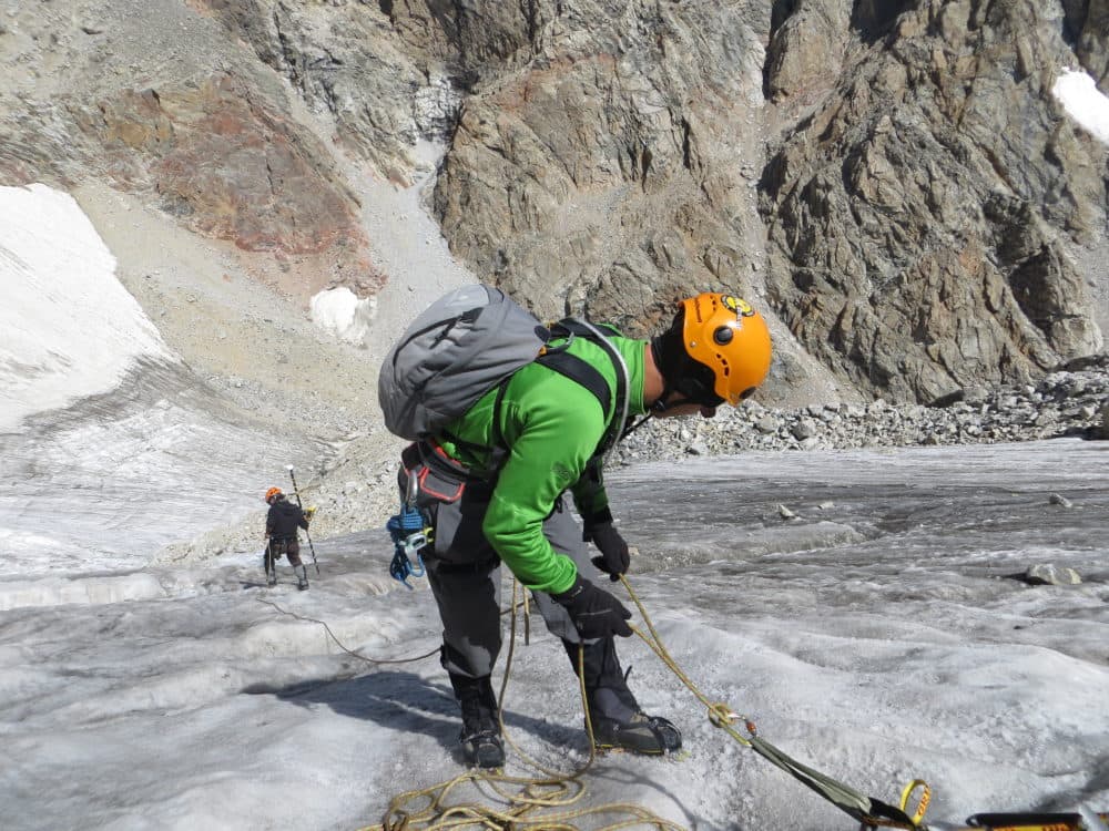
The park launched a program in 2012 to monitor and measure changes on several of the glaciers within its boundaries, using time-lapse cameras and high-accuracy GPS units to measure size.

Last year the park joined forces with the Forest Service to start an ecosystem-wide glacier monitoring program. Researchers will monitor one glacier in the Wind River Mountains, one in the Beartooths and one in the Tetons using standardized methodology to compare changes.
“It’s really exciting we are looking at it from an ecosystem perspective,” Caskey said.
It’s a chance to understand how glaciers contribute to the watershed and fish and wildlife habitat, and to get a handle on how quickly they are declining and what that means for the ecosystem, he said.
There are 12 glaciers—10 named—in Grand Teton National Park. The park selected the Middle Teton Glacier, just below the summit of the 12,805-foot mountain to survey year-to-year, because of its accessibility, Caskey said. Other glaciers like the Schoolroom glacier, with its steep face and crevasses, or the Teton Glacier, known for rock fall, made regular monitoring dangerous, he said.
The Forest Service and other academic partners used the 2017 summer field season for reconnaissance — to examine their options and determine which glaciers to monitor.
“Our glaciers are so accessible when compared to the Wind River and Beartooths,” Caskey said. “It’s another level there.”
Reaching glaciers in those ranges typically require 20-plus-mile hikes through rugged terrain — one way. The project needs glaciers that are both representative of the others in the range and accessible every year, no matter the snow conditions. Researchers will select the glaciers to monitor in the Winds and Beartooths in the next couple of months, Caskey said.

The studies will track the position of the bottom edge of each glacier — the glacial terminus — with GPS units that can measure changes as small as centimeters.
They will also measure the area covered by the glacier using a standardized grid and fixed photo points to see change over time.
Researchers in Grand Teton National Park, with the help of the Jenny Lake Climbing Rangers, will continue to monitor other glaciers in the park with remote time-lapse cameras. They will also use satellite imagery to keep an eye on glaciers that couldn’t otherwise be safely reached on a regular basis, Caskey said.
In Grand Teton, and the Winds, researchers are looking for historical photographs taken by early climbers that show the glaciers. They hope to reconstruct some of the shots to compare with the images from decades before monitoring started.
Caskey also plans to start a citizen science project in Grand Teton that asks climbers to photograph glaciers seen from the peaks they scale. Some of the best photos of the Middle Teton Glacier come from routes on the nearby Grand Teton, he said.
Never miss a Peaks to Plains. Subscribe to our free weekly newsletter.
There is still a lot unknown about the glaciers in the Greater Yellowstone, including how fast they move. Measuring velocity would take drilling a hole deep into the glacier and revisiting the site multiple times in a season. The park hasn’t yet prioritized such costly measurements, he said.
Scientists elsewhere have constructed models to predict when certain glaciers will disappear. That research hasn’t occurred in Grand Teton, but the data gathered by the park annually will allow for some preliminary modeling, Caskey said.
Researchers rarely have the chance to observe geological processes, Caskey said, because they typically unfold over vast stretches of time. “Glaciers are one of our great opportunities to look at something that manifests a dynamic landscape and we can actually see a change on a decadal and human life scale.”
Very informative and well written article. Please keep them coming!
tangential modeling from a super “el nino” period? And the net loss was only two 2500 square foot homes. I think that ain’t so bad. keep the good pictures and math coming. young people deserve no less.