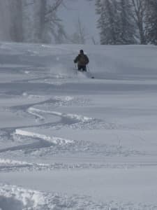
Last year it started snowing in September and people were skiing on Togwotee Pass by the end of the month and on Teton Pass by the end of October, said Jim Woodmencey, meteorologist with MountainWeather.com.

Yet this year, up until yesterday, there was only a sprinkling in the high mountains, while the rest of the ground remained bare. The snow has finally arrived in parts of the state, but does its delayed timing mean winter enthusiasts should worry about the rest of the season? Woodmencey says no.
“What happened last year,” said Woodmencey, “that’s not normal.”
As for this year Woodmencey can’t make any promises. There’s nothing indicating it will be dry, but nothing indicating a big snow year either. While there was a lot of talk of El Nino this spring, it hasn’t really developed yet, so for now it isn’t a factor.
“This one is still a coin flip at this point,” Woodmencey said. “It’s kind of a wait-and-see situation.”
Places around the state have seen less snowfall than normal this fall, said Dave Lipson, a meteorologist with the National Weather Service in Riverton. For instance, by this point in the year Casper normally gets about seven inches of snow; so far this year it’s gotten about half that. While precipitation remained normal across most of the state, there have been warmer than average temperatures, a trend that is expected to continue for the next three months, he said.

That doesn’t mean we won’t see snow. In fact, it’s coming — at least for those in Central and Eastern Wyoming. If it hasn’t hit by the time you are reading this, it’s on its way.
“This is the first event of the year where we’ll have much colder temperatures and the snow to go along with it,” he said.
On Nov. 6, Bob Comey, director of the Bridger-Teton Avalanche Center, checked the center’s forecasting cameras and monitors making sure they were ready to go, while scouting the snow in the area.
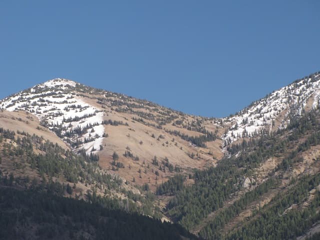
The ground was clear on aspects below 9,000 feet and on sunny landscapes above 9,000 feet.
Only a couple of inches of snow has accumulated on north faces at the high elevations.
“It’s across the board pretty bare,” he said. “And it’s more than just western Wyoming.”
Comey noted that few forecasters across the region were reporting much snow as of the first week of November.
The center starts its daily forecasts once there’s enough snow to warrant worry about avalanches, although it does provide weekly snowpack summaries. In the last 14 years, the latest it’s ever started forecasting was Nov. 17 — that was in 2008. It’s begun regular forecasts as early as Oct. 25 in 2010. As of Nov. 6, Comey wasn’t sure when the center would need to start forecasting this year, but thought it could be a while. There wasn’t much snow predicted for northern Wyoming in the next 10 days.
“But that can always change quickly,” he said. “A week of steady snowfall could change the whole story.”
Parts of Wyoming did experience early season storms that were then followed by warm spells melting most of the snow other than that on the very high north-facing mountainsides, Comey said.

A later start to developing a snow pack isn’t necessarily a bad thing. Early big dumps create a weak surface layer at the beginning of the ski season priming slopes for avalanches. Of course, a big first storm late in the year could cause the same weak layer, but for now hope remains the snow will fall steadily, building up a stable snowpack for the season, he said.
Comey doesn’t bother looking out too far at forecasts. Predictions out more than 10 days are often unreliable.
“The bottom line is Mother Nature could deal us any scenario at this point,” he said. Plus there’s plenty to keep him busy. Comey’s planning to get up high to examine the crystals of the snow that has settled in the mountains.
The Bridger-Teton Avalanche Center received three Recreational Trail Program matching grants last year for a total of $142,000 that will help fund $185,000 worth of projects, including avalanche education courses and new forecasting equipment, which Comey and his team have been setting up and testing.
In addition to using the money to update the electronics at 18 remote weather stations, the center bought webcams for backcountry observation in areas like Togwotee Pass, the Wyoming Range and Salt River Range to help document avalanche conditions. Footage from the new webcams will be available on the center’s website.
Likely it won’t be long before there’s something of interest to watch on the cameras.
The fall has been up and down with cold snaps and warming, but by mid-November colder temperatures should start to settle across the state, Woodmencey said.
Radical weather to the east and west of Wyoming — including enough snow to open ski areas in the Appalachian Mountains — show the weather is changing, he said.
“It is what is and we get what we get,” Woodmencey insists, but a little snow dance never hurt anyone, even if you don’t like winter sports.
“Everyone should want snow,” Woodmencey said. “More snow means more water for the rest of the year.”

